juliamhammond

Latest

Just back from – a day in Budapest

If you’re a regular reader of this blog then you’ll know it’s perfectly possible to have a day out in Europe, so long as you don’t live too far away from the airport and the flight schedules permit an early out, late back pairing.  Following on from my days out in Amsterdam, Belfast, Bremen and Lisbon, the latest trip saw me heading to the Hungarian capital Budapest.  The links to those previous day trips can be found at the end of this post.  As with the others, I’ve been to Budapest before, but well over a decade ago, so I was keen to revisit what had been an enjoyable destination.

budapest

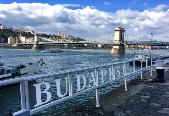
Budapest straddles the Danube

Arriving at midday local time after a civilised 8.30am flight, it was good to hear the famous Ryanair on time hurrah and even better to find that Hungary’s border police valued speed over anything else.  An easy bus and metro ride got me into the centre of Budapest, giving me about six and a half hours in the city after the commute to and from the airport had been factored in.  Once again, having waited for a flash sale, I paid less for my flight than I would have done for a train ticket into London, with my time equating to less than £5 per hour of sightseeing.  I thought that was good value.  The one day travel card, good for bus, tram and metro, was also excellent value at 1650 forints, about £5.

img_6430

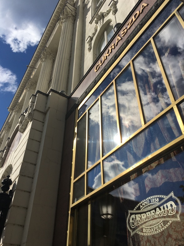
Cafe Gerbeaud has been found at its present location in Vörösmarty tér since 1870

First stop was an old haunt: Cafe Gerbeaud.  Located in Pest, this famous coffee house has been a fixture for well over a century and still knows how to put on the style.  A cappuccino and some delicious biscuits topped up the massive breakfast of huevos rancheros I’d wolfed down at Stansted.  The sun was pleasantly warm for October and so I decided to take a stroll along the banks of the Danube and over the city’s famous Chain Bridge.

img_6434

On the waterfront

With skies blue and visibility good, it was too tempting to take the funicular up Buda’s Castle Hill.  The ticket wasn’t included in the travel card, more’s the pity, but it was 1200 forints for a single ride – hardly break the bank rates.  The views from the top were as fine as any in Europe, with landmarks like Pest’s parliament building easy to spot.

funicular

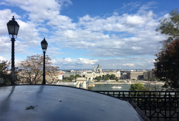
View across to Pest as I ascended the funicular

The castle occupies a prominent position, as you might expect.  There are wine tastings to sample and museums to explore, but one of the great pleasures is just to sit in the sunshine and admire that view over Pest.  As luck would have it, the changing of the guard ceremony was about to start in front of the Presidential Palace just as I reached the top.  A forest of cameras, phones, selfie sticks and mobile phones recorded the occasion, but there was plenty of room for everyone to get their shot.

changing

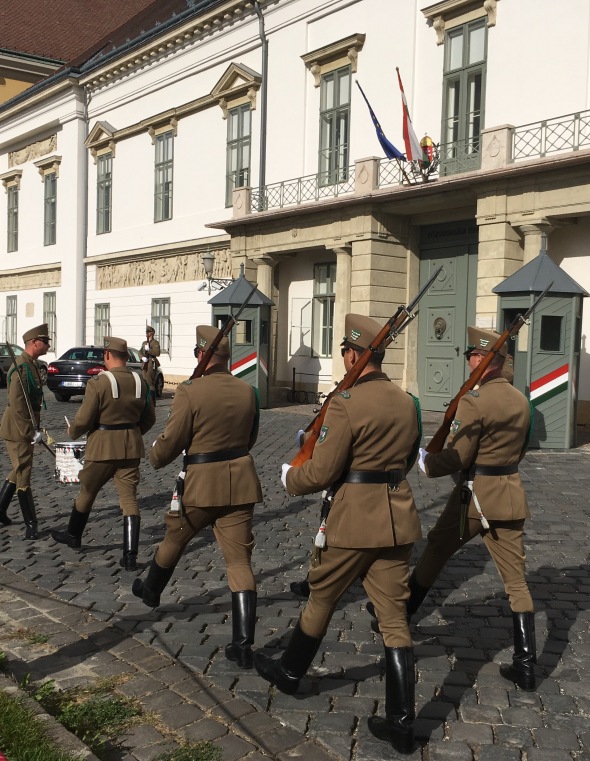
Changing of the guard, a tradition reinstated in 2003

The weather was just too good to resist and so I continued my stroll through Buda’s castle district to picture postcard Fishermen’s Bastion.  It’s not a place to hurry, unless an out of control Segway rider is heading your way.  There are loads of museums and plenty of cobbled streets, and as access to traffic is limited it’s easy to wander around.
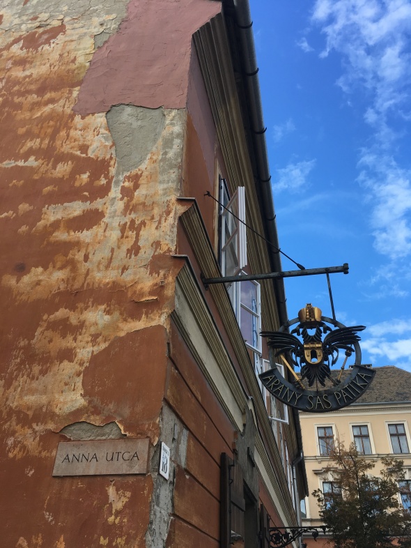
img_6551

Castle District

The white domes of Fishermen’s Bastion have a touch of the Sacre Coeur about them.  The place was constructed between 1901 and 1903, designed to complement the Church of Our Lady which dominates the square adjacent to it.  There’s no need to pay to enter for the view, or to have a coffee in the expensive cafe in the ramparts, though, as you can enjoy the same splendid vistas for nothing if you walk a little further along.

Back on the bus, I headed down to the river to search out an old Turkish Bath I’d read about.  Instead, I found what looked like an abandoned sanatorium but what was actually a working thermal baths.  It turned out to be the Lukács baths, whose website provided a bit of background missing from other web posts about Budapest’s baths:

“The Lukács Thermal Bath has a rich historical background: monastery baths were built in this area as early as the 12th century, the first spa hotel was built in the 1880’s, a drinking cure hall was added in 1937, and a daytime hospital was established in 1979. At the end of the 20th century, the thermal bath was thoroughly renovated and all facilities were modernised.”
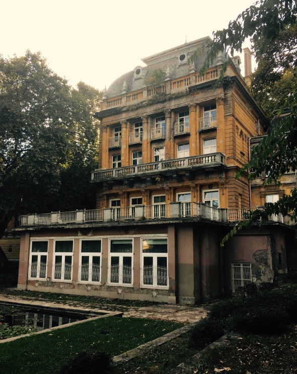
fullsizerender-9

A surprise find

Budapest has loads of them dotted about the city, including the swanky baths at the Gellert Hotel and the famous Széchenyi Baths in City Park.  These were less well known, perhaps off the tourist track because it looked like no one had maintained them for an age.  Undeniably atmospheric, I decided against a dip in case the building fell on me and in any case, it was late afternoon and getting a little chilly.  Instead, I decided to go back to Pest instead for a stroll through City Park.  The lake had been drained for cleaning, alas, so I cut my losses and caught a bus to the market.

fullsizerender-8

Paprika in the market

I could wander around a market all day, and Budapest’s, housed in a glorious building down by the river, is no exception.  Ropes of paprika hung like Christmas decorations from greengrocery stalls and rows of salamis adorned the butchers.  I’d been tipped off about a cheese pastry, a kind of crispy rolled croissant filled with cream cheese and dipped in finely grated cheese.  It was deliciously more-ish.
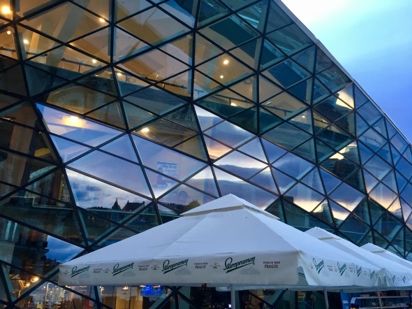
fullsizerender-7

The Whale at dusk

Temptation would have to be resisted though, for almost next door was one of Budapest’s newer architectural efforts.  Known as Bálna or the whale, this modern structure connects several old warehouses with a confection of glass and steel.  It opened, I read, in November 2013 after protracted disputes between the city and the developer, but not all of the units inside had been filled – a mix of shops, bars and restaurants – leading to some commentators renaming it the white elephant.

fullsizerender-6

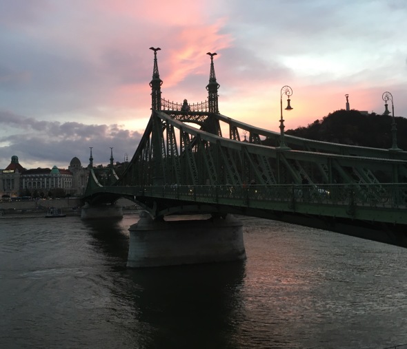
Sunset over the Danube

It was getting late.  The sun had cast a pink hue over the Gellert and left the faintest of reflections in the Danube.  There was just time for a light supper before heading back to the airport for my 9.35pm flight back home.

Previous day trips…

Bremen

https://juliamhammond.wordpress.com/2016/06/07/just-back-from-a-day-trip-to-bremen/

image

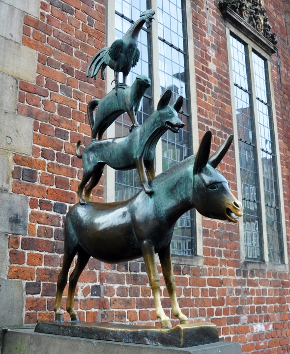
The four budding musicians

Lisbon

https://juliamhammond.wordpress.com/2014/10/20/just-back-from-a-day-trip-to-lisbon/

View from Mirador Portas do Sol

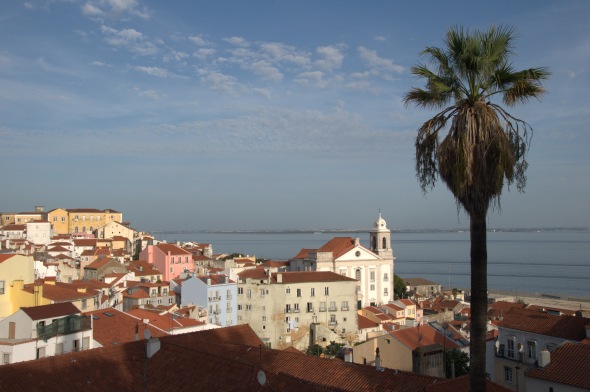
The Alfama district seen from the Mirador at Portas do Sol

Amsterdam

https://juliamhammond.wordpress.com/2015/01/26/just-back-from-a-day-trip-to-amsterdam/
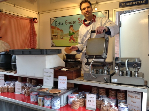
image

The Stroopwafel man

Joshua Tree National Park

U2 fans take note: if you rock up to Joshua Tree National Park looking for that tree, you’ll be disappointed. The iconic image that featured on the band’s 1987 album cover was actually taken by the side of the SR190, a couple of hundred miles away up near Darwin, CA. There’s no point in going in search of it as the tree is long gone. In fact, the Joshua Tree National Park wasn’t even a designated national park at the time, though it was a national monument. Its status was upgraded in 1994.

img_6409

A visit to the park is a rewarding experience. It’s basically divided into two distinct zones: the Colorado desert to the south and the higher and slightly wetter Mojave Desert to the north.  As with many US national parks, a road cuts through the park. If you’re driving, enter from the south as the scenery will improve as your day goes along rather than the other way round.

img_6411

The cholla cactus garden (pronounced choy-a in the Latino way as with most place names in these parts) is one of the highlights of the south side of the park. Much of the road leading to the area is lined with fairly featureless scrub, the barren landscape dotted with creosote bushes and the cactus-like ocotillo trees which despite their appearance aren’t cacti at all. Aside from almost running over a snake, we saw almost no wildlife at all which wasn’t a surprise given the landscape and the high temperatures.

img_6412

Cholla cacti almost have the appearance of cuddly bears – if your imagination is wired that way – but are extremely hazardous. Their prickles are incredibly sharp, and they get their nickname of jumping cactus from their propensity to detach.

img_6410

Straying from the path could be a disastrous decision. That path is sufficiently wide not to cause a problem, but as with walking the beam in gym class, there’s something about knowing you can’t wobble that makes you wobble. As someone with short sight and thus poor peripheral vision, it was a slightly stressful walk. Back at the hotel later, I found this video on YouTube showing what happens if you’re not so careful – and it’s excruciating viewing:


Back in the car without incident, the road climbed steadily, taking us into the Mojave and ramping up the scenic quality to something worthy of National Park status.  Pulling over, we were treated to the sight of Skull Rock, which as its name suggested had been sculpted into something resembling a human skull.

img_6408

The geological story of much of rocky Joshua Tree is one of volcanic intrusion – molten monzogranite pushing its way up into the overlying Pinto gneiss. As the magma cooled, the granite cracked. Over time, chemical weathering widened those cracks and rounded off the rock into the huge monzogranite boulders that litter the landscape today.

img_6404

After Skull Rock came Jumbo Rocks, which were pretty much what they said they were. If at first we had been in any doubt as to whether this desert deserved to be a national park then those doubts had now evaporated. Some people run America down, but in terms of sheer scale, its majestic scenery cannot be beaten. I know the word is overused, but it is awesome.

img_6413

Turning off the main highway, we climbed for a short while to Keys View. Fearing snakes, scorpions and tarantulas, it turned out to be something much more common that caused us the biggest headache in terms of creature discomfort – honeybees. Attracted by moisture, and not caring whether that came from human perspiration, a/c condensate or half-drunk Coke in the car’s cup holder, those pesky insects created quite the nuisance of themselves. Fortunately we were able to get them back out of the car fairly easily and – with much relief – without being stung, leaving us free to appreciate the views across the valley to Palm Springs and even as far as the Salton Sea in the hazy distance.

img_6406

Descending to the valley, the road took us to the start of the Barker Dam loop trail. It wasn’t far, along a well marked and graded gravel path, though in the intense heat (by British standards anyway) it was far enough. The dam was constructed around 1900 to store water for the cattle which were grazed here as well as for the local mines. It’s rain-fed, but visiting in the autumn meant that the reservoir was bone dry, leaving visitors to ponder the wisdom of trying to rear livestock in such an inhospitable location in the first place.

img_6403

Not far from Barker Dam lies Hidden Valley, one of the park’s landmark attractions and the only place we saw a tour bus. Once the hideout of cattle rustlers, now it’s aesthetic qualities that draw humans. Steps wind up through the rocks to a clearing crammed with vegetation: cacti, yucca and several species of trees have colonised the area naturally protected from the wildest weather. Overhearing a guide, I learnt that even a seemingly spine-free cactus was actually a hazard. Touch what seemed like a smooth surface and microscopic spines would embed themselves into the skin – almost impossible to remove without the aid of duct tape. Ouch!

img_6405

My verdict? Visit Joshua Tree for sure, but remember it comes with a health warning!

On a mission in San Juan Cap, California

With so many names and signs in Spanish, let alone the number of voices you’ll hear speaking the language, it’s hard to ignore that this part of the USA was once Spanish. In the heart of Orange County, midway between Los Angeles and San Diego, I visited the little town of San Juan Capistrano, drawn by the mission of the same name. (And a really good Mexican restaurant, but that’s another story…)

img_6387

Originally founded in 1775, Mission San Juan Capistrano was the seventh of twenty one such missions in what was them known as Alta California. Spain wished to expand its territory and at the same time, convert the native Americans to Catholicism. The missions were designed to be a place of learning and training, though of course, once converted to upright Spanish citizens, the native population would also be paying tax. The Spanish brought their own animals, food and technology, all of which piqued the curiosity of the locals. Once sucked in, however, there was no going back: converts could not leave the mission grounds without permission. By 1806, Mission San Juan Capistrano had a population of more than 1000 people.

img_6388

At its heart was the delightful Great Stone Church. Today, this church stands as a ruin, destroyed in an earthquake in 1812. The two bells that sit in front of the structure are actually originals, named San Vicente and San Juan, the latter damaged in the quake, though the four that swing from the bell tower are newer.

img_6390

The mission collapsed too, let down by the Spanish government so failed to send essential supplies, its residents plagued by outbreaks of disease. The final nail in the mission’s coffin came in 1821. Mexico became independent of Spain and with that, Alta California was no longer a Spanish possession. The Mexican government officially ended the mission system in 1834 and the MSJC’s land was parcelled up and sold to twenty prominent local families. In 1845, the mission itself was sold by the then governor to John Forster, who used it as the family ranch. He paid just $710 for it though its value was over $54000. Did I mention he also just so happened to be the governor’s brother in law?

img_6386

Things changed again in 1848. Mexico lost the Mexican-American War and under the Treaty of Guadalupe Hidalgo, California was ceded to the Americans and became a state in 1850. President Abraham Lincoln was petitioned to return the missions to the Catholic church and like many, Mission San Juan Capistrano was the recipient of much needed attention and funds from well-heeled philanthropists. Today, such work continues, and visitors and benefactors continue to ensure the mission survives, adding their own flourishes to the existing structures. The fountain in the main courtyard, full of water lilies, is one such embellishment. It’s a tranquil place despite the sightseers, its courtyards full of cacti and hibiscus, framed by brick arches and adobe walls.

img_6391

The Serra Chapel that stands alongside the ruined Great Stone Church is a still a working church. Its adobe walls are left partially uncovered enabling you to see how it was constructed. Inside, its simple figurines and carvings stand alongside intricate wooden carvings overlaid in gold leaf, allowing to be both rustic and ornate at the same time. The altar, imported from Barcelona, is about 400 years old.

img_6392

Many visitors come to witness what the mission calls the “miracle of the swallows”. On March 19, the town celebrates the return of swallows from the south. I’m guessing there are some people out there who are gullible enough to believe this is the actual date, but anyway, March is the general time to expect them. The migrating swallows build nests in the nooks and crannies of the church walls where they stay until October. It would be another month before they would return to Argentina. I didn’t see any, but was assured they were there. It said so in the leaflet.

Tips for keeping yourself – and your stuff – safe while you’re travelling

Travel safety is a big consideration for most travellers and as a solo female, it’s something that has to be thought about, both at the planning stage and while I’m on the road. Here’s some advice based on what I’ve learned over the years about keeping myself safe.

Plan before you go

I hold what I call my reserve bucket list. I contains places that I hope to go to one day, but for safety or security reasons aren’t top of the list right now. One of the websites I go to when I have a trip idea involving somewhere that might just be a bit dodgy is the FCO’s – and in particular its Travel Advice by Country. Sometimes it can make for scary reading, but knowledge is never a bad thing. The FCO’s up to date facts about a country can help rule it out – sorry, Mali, you’ll just have to wait in line with Yemen – but where it’s clear that any issues involving safety are contained to a specific part of the country, it can sometimes rule a country in.

guatemala-img_0739

Guatemala – one place where the FCO’s advice helped me prepare

Keep abreast of news while on the road

I’ve found Twitter to be an invaluable help in finding out what’s going on within a country from the inside. In Haiti last year, it was the most accurate way of tracking the unrest triggered by fuel price rises and ensuring that I didn’t leave sleepy Jacmel too early. It’s also been handy to check how the roads are running in and out of Calais when my family have taken a cross Channel ferry during the recent difficulties.

dsc_0060

Haiti – not the safest place to travel but  certainly interesting

Think about luggage

Habitually I travel with a rigid-shell wheelie, which would be harder for thieves to slash than a soft suitcase. My aim is usually to appear a more difficult target than someone else, so to that end I ensure zips and fastenings are done up, small padlocks secure outside pockets from interfering fingers and bags are worn cross-body so they can’t easily be slipped off my shoulder. Valuables are buried deep within inside pockets and expensive equipment like cameras are in plain bags rather than labelled ones with Nikon or Canon clearly visible. One thing I never do, though, is wear my rucksack on my chest – personally, I just think that marks you out as a dumb tourist and makes you more of a target.

DSC_0677

My trusty travelling companions, seen here waiting for a ferry in the Seychelles

Trust your instincts

Over the years I’ve either been lucky or I’ve developed the skill of knowing when something just doesn’t feel right.  Of course, I could have been blissfully unaware of any potential danger.  Sometimes, you just have to go with your gut and accept help or hospitality from complete strangers.  I’ve trusted people to give me a lift and turned others down simply because it didn’t seem right; spoken to others at length and entered their homes while avoiding eye contact with others.  One of the most rewarding aspects of travelling is the encounters you have with people along the way, which would be impossible if your guard was always up.  So far, though I shouldn’t want to jinx my luck, I’ve never got myself into any situation I couldn’t get out of.  Perhaps that’s the key – have an exit strategy in the back of your mind.

img_6172

I’ve been rescued by a group of Rastas in Zambia

Choose accommodation in a safe location

It can be tempting to book a hotel or hostel near a bus or train station but I do check first to find out if that puts it in an insalubrious district. Better to have a short taxi ride or subway trip than to risk walking around somewhere that I’m more likely to get robbed. That’s especially important if I’m arriving after dark, which may be earlier than at home, of course. If arriving after nightfall is unavoidable, then I’ll almost always take a taxi; to do otherwise could be false economy. It’s also good to take local advice.  The hostel I stayed at in Windhoek, Namibia’s capital, was very clear with the advice posted on its gate: leave anything behind that you didn’t wish to lose – pickpockets were, sadly, rife.

img_2222

Damascus in the daylight

Ironically as it turned out, when I visited Syria just months before the civil war kicked off, I took the airport bus from Damascus into the city and then walked alone through its deserted streets at 2 am – and have rarely felt safer than I did that night. Perhaps safety is a state of mind?

Happy Mexican Independence Day!

September 16 is Mexican Independence Day.  Outside Mexico, it is overshadowed by the Cinco de Mayo celebrations which many confuse with Independence Day.  In fact May 5 is the anniversary of Mexico’s victory over the French at the Battle of Puebla in 1862. Mexican independence instead was won from the Spanish in 1821 after a war which commenced on September 16 1810.

The fight to extricate Mexico from Spanish rule began with what’s known as the Grito de Dolores, translating as the Cry of Dolores, a rallying cry designed to incite revolt. It was uttered in the small town of Dolores, located a short distance from the colourful city of Guanajuato in central Mexico.  The exact words that marked a new chapter in Mexico’s history have been forgotten, but the man who spoke them has not, Miguel Hidalgo y Costilla, a Catholic priest whose statue you’ll find in Guanajuato.  Hidalgo was executed a year later but his country owes its freedom to his bravery.

img_7118-1

Place of Frogs?

I took a bus to Guanajuato a few years back, travelling from the pretty artists’ enclave of San Miguel de Allende.  Arriving in the place they call the “place of frogs” because early residents thought the surrounding hills looked like one, I was struck by the city’s colour.  Looking like a city that has shares in Dulux, almost every building is painted a vibrant shade.  Individually, they’re pretty, but the overall effect is stunning and it’s no surprise to learn that they’ve earned a UNESCO listing.  I took the funicular up to the statue of El Pipila and looked down over the Teatro Juarez immediately below.  It really is a splendid place.

img_7104

Overlooking Guanajuato from El Pipila

Once, Guanajuato was a mining town, sitting on vast reserves of silver, making it one of the most productive mining areas in the country.  The La Valenciana mine, located in the village of the same name, brought huge wealth to the Spanish mine owners and provided many labouring jobs, but it was closed down when the Spanish were given their marching orders.  The mine did reopen, but is now permanently shut, though tours are available.  Even if you don’t descend underground, it’s worth heading to La Valenciana to see the ornate San Cayetano church.

Back in Guanajuato, one of the best ways to appreciate the city is on foot, wandering along the many alleyways, including the Callejon del Beso (the alleyway of the kiss) where it’s so narrow it’s possible to kiss your lover from balconies on opposite sides of the street. Cafes are another thing that the city does well, scattered in the plazas that are lined with museums, theatres, churches and historic mansions.

img_7090

Bronze sculpture of a musician outside San Diego church

The day is marked with fiestas, flags, parades and partying.  Whether you’re in Mexico or not, I’m sure you’ll join me in raising a glass to that.  Viva Mexico!