How tough is the hike to Chalaadi Glacier?
The older I get and the more my knees creak, the more I need to research possible hikes before setting on to ensure I don’t end up with aching muscles or worse, being stretchered out. But no one, least of all me, wants to find out that they’ve missed out on superb scenery on a hike that would have been perfectly within their capabilities. So when I found out about a glacier accessible from Mestia on foot, I set about reading up. The trouble is, many of those who post are young and fit. Their definition of an easy hike isn’t necessarily what I’d call easy. So here are the facts about hiking to the Chalaadi Glacier.

You don’t have to walk all the way
Technically, the Svans consider this hike a 25km round trip. The official tourist board literature states the duration of the hike as being eight hours. That’s beginning and ending in Mestia and walking up the road past the airport until it runs out. Well, 25km would take me more than eight hours including collapses, even if much of it is fairly flat.

Keen not to have to quit before the good bit, I hired a lovely driver called Nodani. I found him in the main square in his adapted Subaru – look for the Subaru sunshield and a disabled badge in his rear windscreen. He agreed to drive me to the suspension bridge that crosses the River Mestiachala. It costs a flat rate of 80 lari (about £26). It’s also possible to rent horses, but they looked pretty frisky and once you pay for the guide too, it’s not a cheap option.
Allow time to enjoy the hike
Most people book a two hour gap between rides; I made it three so as not to have to rush. I was keen to take the hike at a steady pace and allow enough time to appreciate my surroundings. I thought I’d make an afternoon of it but in actual fact got back thirty minutes ahead of schedule. No biggie: there’s a cafe at the bridge where I waited for Nodani to come and collect me.
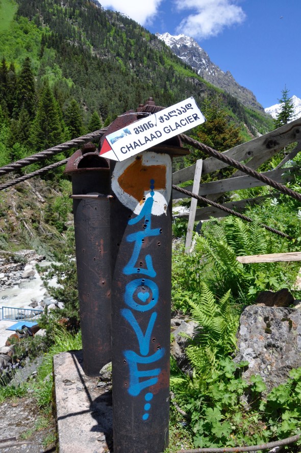
You won’t get lost
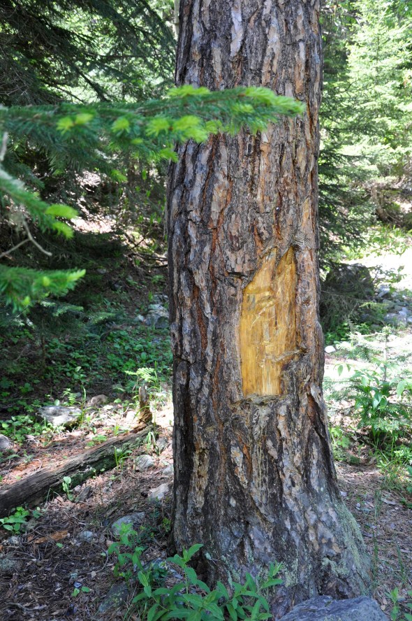
A concern if you’re hiking solo, as I was, is getting lost. Most trails are marked but the frequency of such signs can be less than you need. Not so here, where they’ve helpfully painted red and white rectangles on assorted rocks and tree trunks. There was even an arrow cut into the tree trunks in some places. It was very clear which direction you needed to take, so you won’t get lost.
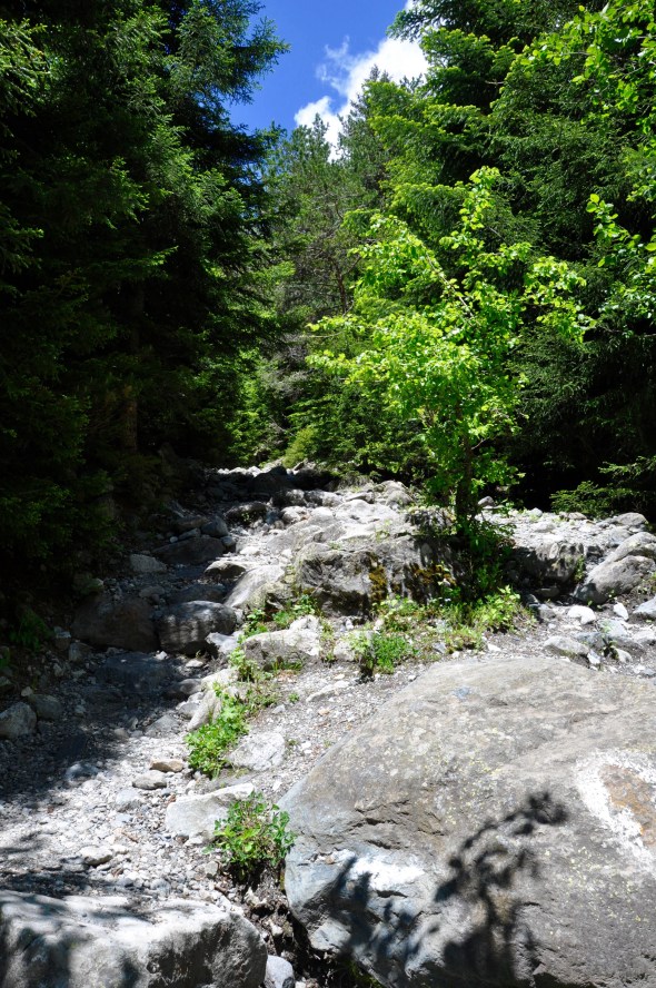
The uphill bits were a bit of a slog
Remember, I’m no athlete. If you are reasonably fit, then this will be a piece of cake. But the altitude at the river is around 1600 metres above sea level, rising to about 1920 up near the glacier. If like me you live at sea level, the thinner air won’t help either. But it’s shady amid the trees and where the route passes through the forest, you’ll see plenty of pretty flowers and lichen covered rocks.

The path wasn’t difficult to navigate as the stones formed a natural staircase. I took frequent rests and carried plenty of water. Further up, heavy rains a few days before my hike meant the water was running high and parts of the path had turned into a shallow stream. Luckily it wasn’t deep enough to leave me with wet feet.
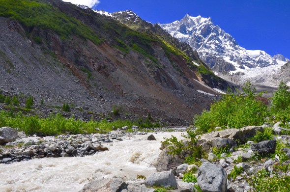
You have to cross a boulder field
About halfway to the glacier, you reach an area where rockfalls have created a big obstacle. Boulders of various sizes lie piled up. Some are steady, others move disconcertingly beneath your feet. I fell foul of such a hazard when I hiked one of Sweden’s High Coast trails last year and ended up with a nasty cut and bruised elbow. There are also deep gaps between some of the stones, meaning a misstep would leave me with a twisted ankle or worse. This was the scariest part of the hike, more so on the way back down as higher up the slope I could hear rocks falling. Fortunately I managed to cross without incident and didn’t end up a casualty of a rock avalanche. You’ll need decent boots though.

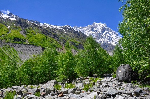
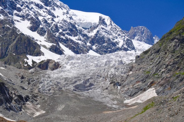
You can cut out the very top part of the hike and still see the glacier
Once you’ve successfully negotiated the boulders, the path is an easy one and leads to a flower strewn meadow by the river. Here, you get a fabulous view of the glacier itself and in its mountain setting, it really is a spectacular view. Turn around, and you’ll see mountains behind you too. Unless you’re really dead set on touching the glacier, you’ll be scrambling over terminal moraine to get any higher. Personally, given the timing of my visit in early summer when the ice is melting and there’s a real possibility of being hit by falling ice or rocks, I didn’t continue. If you carry on, as many do, it’s advisable to use walking poles.
Is it worth it?
That’s a resounding yes! If the weather’s playing nicely as it was during my visit, it’s hard to imagine a better way of spending an afternoon. But to maximise your time spent at the scenic parts of the trail, I’d definitely advise hiring a driver for that dull airport road.